DARLA @ New River Inlet: OSU X-Band radar
|
The OSU Radar Remote Sensing Group participated in the RIVET-1 experiment at New River Inlet. Our group was funded through the ONR-Data Assimilation and Remote Sensing for Littoral Applications (DARLA) project. DARLA is a multi-institutional project that is testing the following three hypotheses:
- Environmental parameter estimation using remote sensing techniques can be significantly improved by fusion of multiple sensor products.
- Data assimilation models can be adequately constrained (i.e., forced or guided) with environmental parameters derived from remote sensing measurements.
- Bathymetry on open beaches, river mouths and at tidal inlets can be inferred from a combination of remotely-sensed parameters and data assimilation models.
|
Click here to see some pictures from the experiment.
DARLA partners:
|
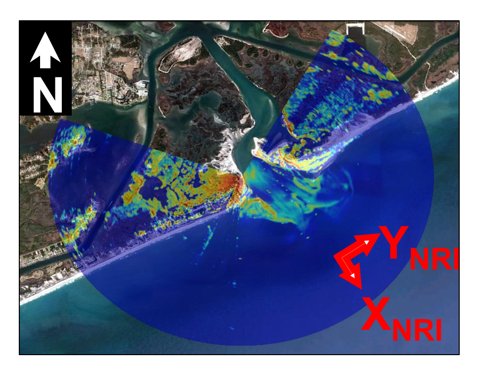
Our Wave Imaging Marine Radar (WIMR) was deployed near the top of a scaffolding tower at Topsail Beach, NC [Lat. 34.529703N, Long. 77.344413W]. It recorded backscatter intensity for approximately 20 minutes every half hour from May 7th through 22nd, 2012. For a synopsis plot of data aquisition times vs tide level, click here. The following are examples of information derived from the radar analysis (click to enlarge):
WIMR footprint overlaid on Google Earth
|
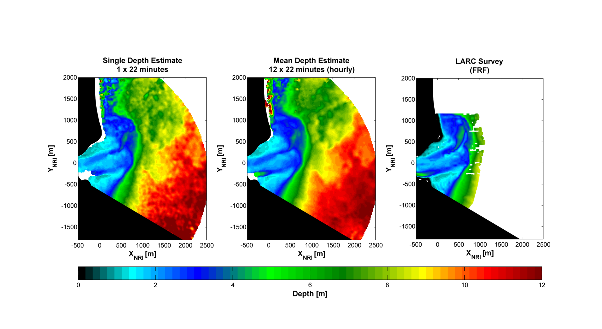
Radar-derived bathymetry estimated through the cBathy algorithm
(Holman et al., 2013)
|
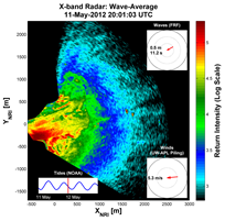
Movie of wave-averaged radar backscatter.
|
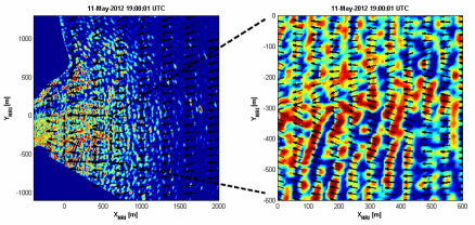
Movie of radar backscatter timeseries. Black arrows represent wave vectors derived following Plant et al., 2008. [PDF]
|
Additional WIMR products available upon request. Please contact Mick Haller at merrick DOT haller AT oregonstate DOT edu.